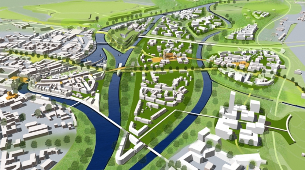
Dutch history is synonymous with water management, but our over 1000 year history of living with water does not make us immune to the modern-day flooding threats imposed by climate change. In fact, The Netherlands is considered to be among the most threatened countries in the world against global sea rise, and as the first to be hit, we have been continuously planning and building against this for decades.
As a country situated on a major river delta to the sea, with much of the population living below sea level, Holland is currently battling flooding on two major fronts: at sea (with global sea-level rises, but also the threat of powerful storms), and along rivers (whose behaviours are also changing from global climate change, but also through man-made interventions such as the channelization of rivers).
Holland is carved out of water, where both the mighty Rhine River and the Meuse River empty into the North Sea. These rivers are important sources of fresh water for much of the country, and also provide essential transportation routes for freight vessels to transport goods, and building materials for much of the country’s major earthworks. Over the centuries, Dutch people have adapted these rivers to suit their needs and improve land, water, and resource management, first by building and continuously reinforcing dykes, and then my channelizing rivers.
In 1993 and 1995 the unexpected happened. The Netherlands, which was so well-protected from the sea thanks to the major earthworks and extensive dyke system built over the previous decades, had to evacuate 250,000 residents and countless livestock due to dangerous water levels from its internal river system. The extreme water levels were the result of climate change, including high volumes of melt and rain water upstream along the Rhine and Meuse rivers, and aggravated by the decrease in permeability of the channelized river systems.
Unlike the floods of the 1950s along the Dutch sea front, this time disaster was avoided. But the near-floods made a big impact on Dutch policy towards water safety and an approach of cooperating with water, rather than evacuation and reconstruction, was embraced. It was agreed that rivers must be given the space to flow freely, restoring the natural balance between water and land.
The new approach to water management combines the idea of making more space for water with interventions to improve the spatial quality of the river surroundings. Nine interventions have been proven to increase the conveyance of rivers to reduce peak water levels, and these have been tried and tested in the River Delta Plan over the last decade, and set to be completed by 2015.

The Development Strategy for the River Warta and Poznan in Poland is an excellent example of how Dutch knowledge, coupled with local context analysis, can provide solutions to water management issues all over the world. This project applies this new approach to water management in an integrated plan and proposes several pilot projects which address water safety in Poznan, while bringing the Warta River back to the historic city centre.
The STAR-FLOOD project is a European-wide initiative to analyse, explain, evaluate, and design policies to better understand long-term solutions to flood prevention. This project illustrates the essential role of a carefully considered process of waterfront development, and demonstrates Waterfronts NL’s expertise in project and process management.
The Veessen project demonstrates how a variety of uses along a waterfront can complement each other while providing space for a river to overflow, and is an excellent example of a small-scale project for a community who wanted to transform a flooded tourist area into a true recreational attraction for residents and visitors alike.